Map shows number of COVID-19 cases varies widely across Canada
It only takes one look at the Canadian government's map of COVID-19 cases in each province and territory to realize the differences are pretty big.
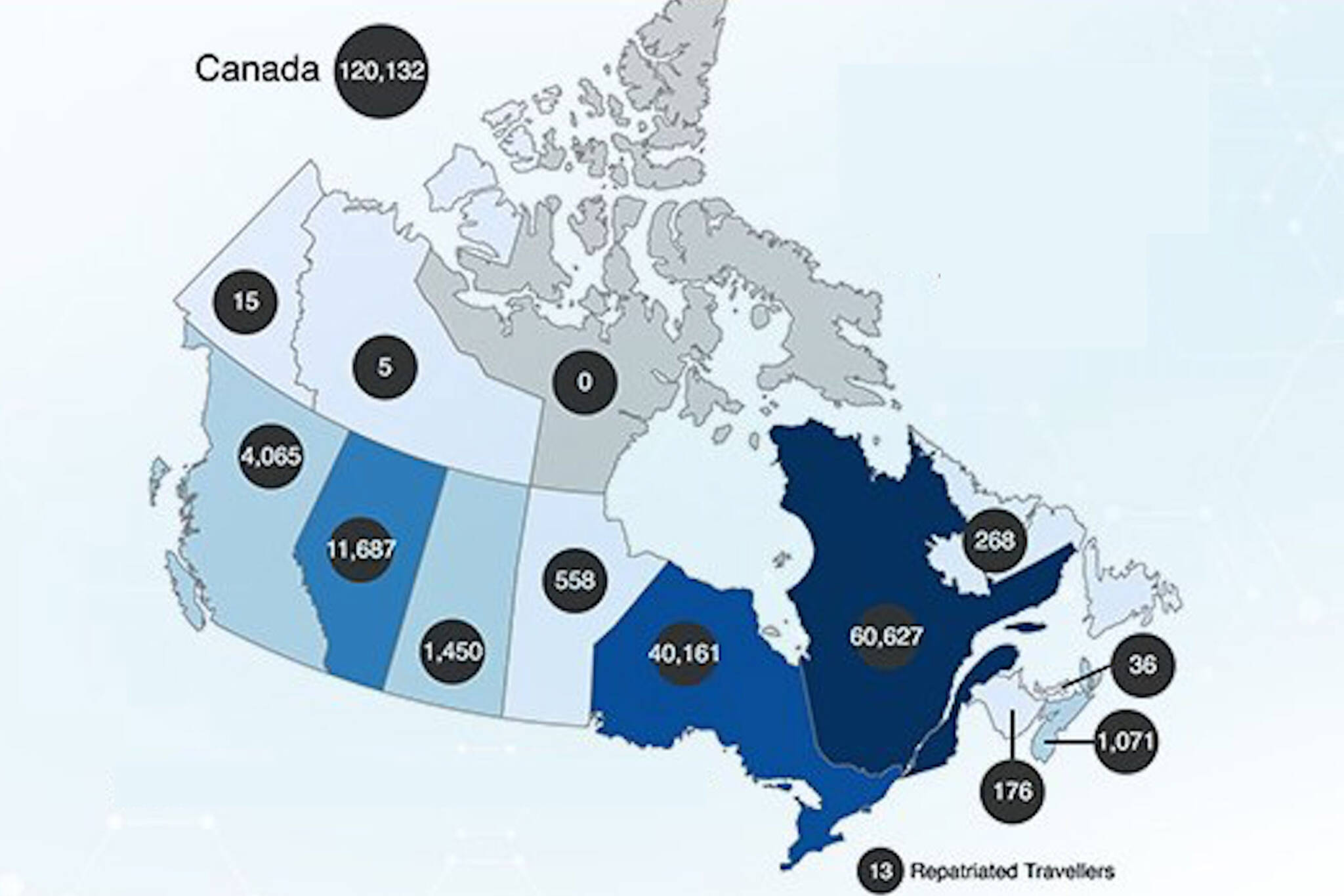
Canada's chief public health officer, Dr. Theresa Tam, tweeted the map out on Tuesday which shows that Quebec has been hit the hardest with 60,627 cases. Ontario comes in second with 40,161 cases.
At the other end, the country's territories have the least number of cases with the Yukon at 15, the Northwest Territories at five, and Nunavut at an impressive zero.
Prince Edward Island is also quite low with only 36 cases to date.
Today’s #COVID19 #Epidemiology in Canada Daily Update: https://t.co/OWrBQUTuod pic.twitter.com/JExrSDuBQh
— Dr. Theresa Tam (@CPHO_Canada) August 11, 2020
Alongside the map, the Canadian government also released a few other key updates. This includes the total number of coronavirus cases in Canada which stands at 120,132.
Of that 120,132, there are 4,790 active cases, 106,355 recovered cases, and 8,987 cases that resulted in death.
The data also shows that over 4,505,218 Canadians have been tested for the virus so far.
While each province and territory has their own plan for re-opening, there are federal rules in place that everyone must follow, despite a steady decline in COVID-19 cases across the country.
These include a 14-day quarantine after travelling, wearing a mask on a plane, and of course, physical distancing.
Latest Videos
Join the conversation Load comments